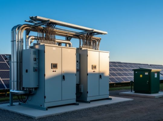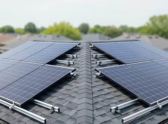
A solar energy assessment is a systematic evaluation of a location’s solar potential and the technical, economic, and environmental feasibility of installing photovoltaic systems at that site. This process combines solar resource measurement, site-specific analysis, and energy yield modeling to determine whether solar power represents a viable investment and how best to design a system for optimal performance.
The assessment matters because installing solar panels without proper site evaluation can lead to underperforming systems, financial losses, and missed opportunities for energy savings. A thorough assessment prevents costly mistakes by identifying shading issues, structural limitations, and grid connection challenges before construction begins. For homeowners considering a solar installation, the assessment reveals whether their property can generate sufficient electricity to justify the investment. For professionals entering the photovoltaic industry, understanding assessment methodology forms the foundation of competent system design and project development.
This article explains what happens during a solar energy assessment, from initial site surveys through financial modeling. You’ll learn how solar professionals measure irradiance, evaluate roof conditions, calculate energy production, and translate technical data into actionable recommendations. The process involves multiple components including solar resource assessment, which quantifies the sunlight available at a location, and PV energy yield modeling, which predicts how much electricity a proposed system will generate over its lifetime.
Whether you’re evaluating solar for your home, starting a career in renewable energy, or managing solar projects professionally, understanding assessment fundamentals helps you make informed decisions backed by data rather than guesswork. The assessment process has evolved considerably with advances in satellite imagery, drone technology, and simulation software, making evaluations more accurate and accessible in 2026 than ever before. Programs offered through collaborations with universities now train the next generation of solar assessors in these modern methodologies, ensuring the industry maintains rigorous standards as it scales.
What Solar Energy Assessment Means
Solar energy assessment is the systematic evaluation of how much solar radiation a specific location receives and how effectively that energy can be converted into usable electricity. This process combines meteorological data analysis, site-specific measurements, and modeling techniques to determine whether a location is suitable for solar photovoltaic installation and to predict system performance over its operational lifetime.
The assessment serves multiple critical purposes. For residential and commercial property owners, it answers the fundamental question of whether investing in solar makes technical and economic sense. For developers planning utility-scale solar farms, it provides the data needed to secure project financing and power purchase agreements. For utilities and grid operators, these assessments inform renewable energy integration strategies and capacity planning.
The scope of a solar energy assessment varies based on project scale and development stage. Preliminary assessments use regional solar resource databases and satellite imagery to screen potential sites and generate ballpark estimates of energy production. These initial evaluations typically cost less and deliver results quickly, making them useful for early-stage feasibility analysis or comparing multiple candidate locations.
Detailed technical studies go several steps further. They incorporate on-site measurements, shade analysis, structural evaluations, and sophisticated computer modeling to produce precise energy yield forecasts. These comprehensive assessments account for local microclimate conditions, shading from nearby objects throughout the year, optimal panel placement and tilt angles, and system-specific performance characteristics. The resulting reports form the technical foundation for final investment decisions and equipment procurement.
Understanding the core metrics is essential to interpreting assessment results:
- Solar Irradiance
- The instantaneous power of solar radiation received per unit area, measured in watts per square meter (W/m²). This tells you how intense the sunlight is at any given moment.
- Global Horizontal Irradiance (GHI)
- Total solar radiation received on a horizontal surface, combining both direct sunlight and scattered light from the sky. GHI serves as the baseline measurement for most solar resource assessments.
- Direct Normal Irradiance (DNI)
- Solar radiation received directly from the sun on a surface perpendicular to the sun’s rays, excluding scattered light. DNI is particularly important for concentrating solar technologies.
- Diffuse Horizontal Irradiance (DHI)
- Solar radiation scattered by the atmosphere and clouds, measured on a horizontal surface. DHI becomes the dominant component on overcast days.
- Peak Sun Hours
- The equivalent number of hours per day when solar irradiance averages 1,000 W/m². A location with 5 peak sun hours receives the same total daily energy as 5 hours of full-intensity sunlight.
- Capacity Factor
- The ratio of a system’s actual energy output to its theoretical maximum if it operated at full capacity 24/7. A 20-25% capacity factor is typical for fixed-tilt PV systems in many regions.
These metrics work together to paint a complete picture of solar potential. While a location’s GHI indicates overall resource availability, factors like seasonal variation in peak sun hours and realistic capacity factor expectations determine actual system economics and payback timelines.
How Solar Energy Assessment Works
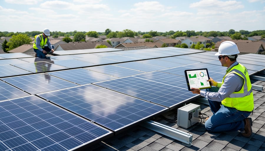
Data Collection and Measurement
Accurate solar resource data forms the backbone of any credible energy assessment, and professionals employ multiple collection methods to build a complete picture. The two primary approaches are satellite-based measurements and ground-based instrumentation, each with distinct advantages.
Satellite databases like NASA’s POWER, the National Solar Radiation Database (NSRDB), and Copernicus Atmosphere Monitoring Service provide broad geographic coverage with spatial resolutions typically ranging from 1 to 10 kilometers. These platforms estimate solar irradiance by analyzing cloud cover, atmospheric conditions, and land surface properties captured in satellite imagery. They offer the critical advantage of historical consistency, with datasets extending back 10 to 20 years, the baseline period required to account for interannual variability and identify long-term trends in solar availability.
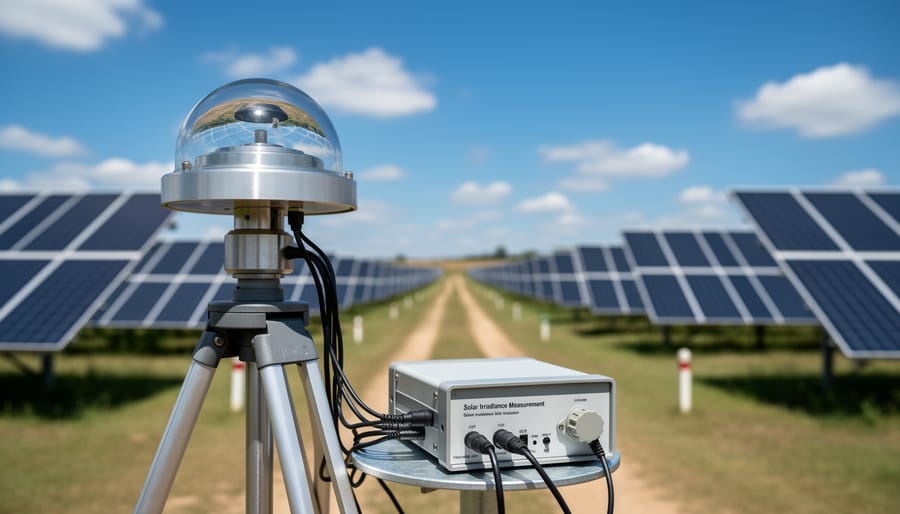
Ground-based measurements deliver higher precision through direct instrumentation. Pyranometers, the industry-standard sensors for measuring global horizontal irradiance (GHI), collect real-time data at specific sites with temporal resolution as fine as one-minute intervals. Meteorological stations equipped with additional sensors capture direct normal irradiance (DNI) and diffuse horizontal irradiance (DHI), providing the complete irradiance profile needed for detailed PV modeling.
Data quality matters immensely. Professionals validate satellite estimates against ground measurements when available, examine gap-filling methodologies, and verify calibration standards. High-quality assessments combine both approaches: satellite data establishes the regional context and long-term patterns, while targeted ground measurements refine site-specific conditions and validate broader estimates for the project location.
Site-Specific Analysis
A proper site evaluation moves beyond regional solar data to scrutinize the actual installation location. PV professionals begin by documenting roof orientation, the azimuth angle relative to true south (in the Northern Hemisphere) or true north (in the Southern Hemisphere). Deviations from the ideal orientation reduce annual energy capture, though the impact varies by latitude and local climate patterns.
Tilt angle optimization follows, balancing maximum annual output against seasonal performance priorities. A fixed array tilted at the site’s latitude often maximizes yearly production, but steeper angles favor winter generation while shallower tilts boost summer yield. Commercial assessment tools now model dozens of tilt scenarios to identify the optimal configuration for each project’s goals.
Shading analysis consumes significant attention because even partial shade on a PV module disproportionately cuts output. Assessors catalog nearby structures, chimneys, trees, and terrain features, then generate sun path diagrams that plot the sun’s trajectory across the sky throughout the year. These diagrams, overlaid with horizon obstructions, reveal exactly when and where shadows will fall. Modern 3D modeling software automates this process, using LiDAR scans or drone imagery to create detailed site models that calculate shading losses hour by hour.
Microclimate factors, localized wind patterns, proximity to bodies of water, urban heat island effects, also enter the evaluation. Higher ambient temperatures reduce module efficiency, while consistent breezes improve cooling and performance. Assessors integrate these variables to refine energy yield predictions beyond what regional meteorological data alone would suggest.
PV Energy Yield Modeling
Once site-specific data is gathered, it feeds into energy yield prediction models that translate raw solar potential into realistic electricity generation forecasts. PV energy yield modeling simulates system performance under actual operating conditions, accounting for the gap between laboratory ratings and field output. Modern models layer multiple loss factors onto the baseline solar resource to produce annual energy projections measured in kilowatt-hours per kilowatt-peak (kWh/kWp).
Temperature effects represent one of the largest performance penalties. Crystalline silicon modules lose about 0.4% to 0.5% efficiency per degree Celsius above standard test conditions (25°C), meaning a rooftop reaching 60°C on a summer afternoon operates at roughly 15% below its rated capacity. Soiling from dust, pollen, or bird droppings further reduces output by 2% to 5% annually depending on local conditions and cleaning frequency. Inverter efficiency, typically 96% to 98% for quality units in 2026, introduces another conversion loss as DC power becomes AC. Module degradation adds a long-term consideration, with most panels declining 0.5% per year, so a system’s 25th year output sits around 12% below its first-year peak.
These losses are aggregated into the Performance Ratio definition a metric expressing actual energy delivered as a percentage of theoretical maximum. Well-designed systems achieve PRs between 75% and 85%, with higher values indicating better design and component selection. Industry-standard software like PVsyst, Helioscope, and SAM incorporate these loss mechanisms, weather databases, and equipment specifications to generate monthly production profiles and financial metrics that guide investment decisions.
Components of a Comprehensive Solar Assessment
Resource Characterization
Resource characterization quantifies the solar radiation available at a specific location by analyzing multiple temporal and spectral dimensions. This process goes beyond simple averages to capture how solar energy varies throughout the day, across seasons, and from year to year.
Solar irradiance data reveals diurnal patterns, how radiation intensity changes from sunrise to solar noon to sunset, which directly affects system sizing and orientation decisions. Seasonal analysis identifies winter-summer variations that can span 50-70% in many temperate climates, informing energy storage requirements and grid integration strategies.
Interannual variability examines how solar resources fluctuate across multiple years, typically using 10-20 year datasets to establish confidence intervals for long-term production forecasts. A site showing 5.2 kWh/m²/day average might vary between 4.8 and 5.6 kWh/m²/day year-to-year, which matters for financial modeling.
Spectral distribution analysis considers how radiation wavelengths affect different PV technologies. Crystalline silicon cells respond differently than thin-film technologies to the blue-heavy spectrum of cloudy conditions versus the red-enriched light near sunset. This characterization ensures technology selection matches the actual radiation profile, not just the total energy quantity.
Technical and Environmental Factors
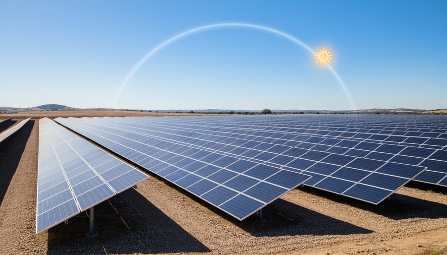
Technical infrastructure begins with structural load capacity verification. A roof design assessment determines whether the existing structure can support panel weight, wind uplift forces, and snow loads without reinforcement. Commercial installations must account for Q-deck roof impact on mounting configurations, while attachment methods like Unistrut support require precise load distribution calculations.
Electrical infrastructure evaluation examines existing service capacity, panel board ratings, and voltage compatibility. The assessment identifies necessary upgrades to accommodate the PV system’s output and confirms adequate space for inverters, disconnects, and monitoring equipment.
Grid connection requirements vary dramatically by scale. Utility-scale grid connection demands substation design and interconnection agreements, whereas residential systems need simpler net metering approvals.
Environmental factors include protected species habitats, wetland boundaries, archaeological sites, and visual impact on surrounding areas. Permitting constraints encompass building codes, fire safety setbacks, historic district restrictions, and local zoning ordinances that may limit system size or placement.
Performance and Financial Modeling
Performance and financial modeling transforms raw technical data into actionable economic forecasts that guide investment decisions. This phase bridges engineering analysis and business viability, converting kilowatt-hour projections into dollar returns.
The levelized cost of energy (LCOE) serves as the primary metric for comparing solar against other energy sources. LCOE calculates the per-kilowatt-hour cost over a system’s lifetime by dividing total lifetime costs (equipment, installation, operation, maintenance, financing) by total expected energy production. A residential system in 2026 might show an LCOE of $0.04-0.08 per kWh, competitive with grid electricity in many regions. Lower LCOE values indicate better economic performance.
Return on investment (ROI) quantifies the percentage gain relative to initial capital outlay. Financial models account for system costs, energy savings, tax incentives, renewable energy credits, and potential revenue from excess generation. A typical residential system might deliver 15-25% ROI over 20 years, though results vary dramatically based on location, electricity rates, and incentive structures.
Payback period identifies when cumulative savings equal initial investment. Simple payback calculations divide system cost by annual savings, while more sophisticated models incorporate financing costs and discount rates for net present value analysis. Current residential installations often achieve payback within 6-12 years, with 13-18 additional years of essentially free electricity generation.
These financial projections directly inform whether a project proceeds, helping developers secure financing and enabling consumers to make confident purchasing decisions.
Applications and Uses in the Solar Industry
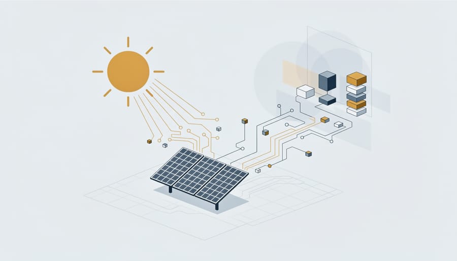
Solar energy assessments serve as foundational decision-making tools across every segment of the photovoltaic industry. Their applications extend far beyond simple feasibility studies, informing technical design, financial structuring, and strategic planning at multiple scales.
In residential solar installations, assessments guide homeowners through the viability question before significant investment occurs. A comprehensive residential assessment determines whether a property receives adequate sunlight, identifies optimal panel placement, and projects realistic energy production figures. These projections directly influence system sizing decisions and help homeowners understand payback timelines. Solar contractors rely on assessment data to provide accurate proposals and set appropriate performance expectations, reducing disputes and increasing customer satisfaction.
Commercial and industrial facilities use solar assessments for large-rooftop or ground-mount systems that can substantially offset operational energy costs. For these projects, assessments must account for complex roof structures, electrical demand profiles, and potential expansion needs. Warehouse distribution centers, manufacturing plants, and office complexes conduct detailed assessments to determine whether solar aligns with their sustainability goals and delivers acceptable returns. Many corporations now require standardized assessments across multiple locations to prioritize which facilities receive solar investment first.
Utility-scale solar developers depend on rigorous resource assessments during the site selection phase. Developers screen dozens of potential sites, comparing solar irradiance levels, land costs, grid connection proximity, and permitting constraints. A difference of just 50-100 kWh/m²/year in annual irradiation can make or break a project’s economic viability at the utility scale, where margins are tight and competition fierce. Detailed assessments feed directly into power purchase agreement negotiations, helping developers and utilities agree on realistic energy delivery guarantees.
Financial institutions and investors require independent solar assessments before funding PV projects. Lenders use these technical reports to validate energy production claims and assess project risk. The assessment essentially serves as technical due diligence, protecting investment capital by confirming that a project rests on sound solar resource data rather than optimistic assumptions.
Government agencies and policymakers utilize regional solar assessment data to craft incentive programs, set renewable energy targets, and identify high-potential areas for solar development. National solar resource databases, built from systematic assessments, help countries understand their solar potential and allocate infrastructure investments strategically. Urban planners increasingly incorporate solar assessment data into building codes and zoning decisions, encouraging solar-ready construction in high-resource areas.
Tools and Technologies for Solar Assessment
Solar professionals rely on an integrated toolkit combining software platforms, databases, and physical measurement instruments. PVsyst and Helioscope dominate commercial PV system design, offering detailed loss modeling, 3D shading analysis, and financial projections. These platforms incorporate meteorological databases like the National Solar Radiation Database (NSRDB) in North America or PVGIS across Europe, which provide multi-decade solar irradiance records at hourly or sub-hourly resolution. System Advisor Model (SAM), developed by the National Renewable Energy Laboratory, offers a no-cost alternative with comparable technical depth, making it accessible to students and smaller firms.
For on-site measurement, pyranometers remain the standard for quantifying solar irradiance. Modern thermopile and photodiode sensors achieve accuracy within 2-3% when properly calibrated and maintained. Drone-mounted thermal cameras now complement traditional site surveys, mapping roof conditions and identifying obstacles at utility-scale installations far more efficiently than manual inspection.
Geographic information systems like ArcGIS and QGIS have become essential for large-scale resource mapping and site screening. These platforms integrate terrain data, shading obstacles, and transmission infrastructure, enabling rapid preliminary assessments across regions. Machine learning tools increasingly refine irradiance forecasting by analyzing historical weather patterns, though they supplement rather than replace physics-based models.
The growing complexity of assessment technologies makes structured training critical. Mose Solar addresses this need through educational programs developed in collaboration with universities, equipping aspiring PV professionals with hands-on experience in industry-standard software and measurement protocols. These programs bridge the gap between academic theory and real-world practice, preparing graduates to navigate both commercial platforms and open-source tools effectively. As assessment methodologies evolve, such partnerships ensure the workforce develops the technical competencies demanded by utility-scale developers, engineering firms, and research institutions advancing solar deployment in 2026.
Common Questions About Solar Energy Assessment
Before investing in a solar installation, most prospective buyers want to know what to expect from the assessment process itself. Understanding common questions about solar energy assessments helps consumers make informed decisions and sets realistic expectations for the evaluation. Below we address the most frequently asked concerns from homeowners, aspiring PV professionals, and project developers.
How accurate are solar assessments?
Professional solar assessments typically achieve 90-95% accuracy in predicting long-term energy production when based on quality data and validated models. Accuracy depends on the data sources used, the assessment methodology, and local climate variability.
How long does a solar energy assessment take?
A basic residential assessment can be completed in 1-3 days, while comprehensive commercial or utility-scale assessments may require 2-6 weeks. The timeline depends on site complexity, data availability, and the level of detail required.
Do I need a professional assessment for a residential system?
While online calculators provide rough estimates, a professional assessment is strongly recommended for residential systems to account for site-specific factors like shading, roof condition, electrical capacity, and local regulations. This ensures accurate system sizing and realistic production forecasts.
What’s the difference between theoretical and actual energy production?
Theoretical production assumes ideal conditions, while actual production accounts for real-world losses from temperature effects, soiling, shading, inverter efficiency, and system degradation. Expect actual output to be 75-85% of theoretical maximum.
Another common concern relates to cost. Professional solar assessments for residential systems typically range from free (included with installation quotes) to $500 for standalone detailed evaluations. Commercial and utility-scale assessments can cost several thousand dollars but represent a small fraction of total project costs and provide essential data for financing and development decisions.
Interpreting assessment reports requires understanding key metrics. Look for annual energy production figures in kilowatt-hours, capacity factor percentages, performance ratio estimates, and shading loss calculations. A quality report should include monthly production profiles, system design specifications, and financial projections with clear assumptions stated. Pay attention to confidence intervals and the meteorological data sources used, as these indicate the reliability of predictions.
Assessment updates depend on project circumstances. For existing systems, reassessments are useful when planning expansions, after significant tree growth or nearby construction, or every 5-10 years to account for evolving technology and updated climate data. New installations benefit from current assessments using the latest modeling tools and recent meteorological records. As solar technology and assessment methodologies continue advancing, staying current with professional standards ensures optimal system design and performance expectations.
Thorough solar energy assessment has become indispensable for successful photovoltaic system deployment, whether you’re planning a residential rooftop installation or a multi-megawatt utility project. The systematic evaluation of solar resources, combined with technical site analysis and energy yield modeling, transforms initial optimism into reliable performance predictions and sound investment decisions.
The sophistication of assessment methods has advanced considerably. Modern approaches integrate satellite data, machine learning algorithms, and real-time monitoring to achieve unprecedented accuracy in resource characterization and performance forecasting. These tools enable professionals to account for complex variables, from microclimate effects to spectral variations, that earlier methods overlooked. Yet technology alone doesn’t guarantee quality outcomes. The interpretation of assessment data, recognition of site-specific constraints, and translation of technical findings into actionable recommendations require trained expertise.
Mose Solar recognizes that advancing photovoltaic deployment depends on cultivating skilled professionals who understand both the science and practical application of solar assessment. Through collaboration with universities and comprehensive educational programs, we’re preparing aspiring PV professionals to master current assessment methodologies and adapt to emerging technologies. These programs bridge theoretical knowledge with hands-on experience, equipping graduates to conduct rigorous assessments that serve homeowners, businesses, and utilities alike.
As solar energy continues its expansion, the demand for competent assessment specialists will only grow. Investing in professional education today ensures the industry maintains the technical standards required for sustained growth and public confidence.